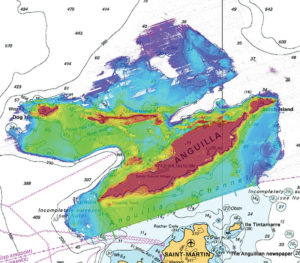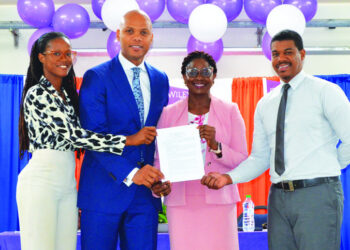
Mr. Sam Harper, International Hydrographic Projects Manager from the UK Hydrographic Office (UKHO), visited Anguilla 19-22 February to check progress on the most comprehensive seabed mapping survey of the seas surrounding Anguilla ever conducted. The EC$1.5m (£450,000) project was funded by the UK Government as part of the UK’s commitment to support maritime safety and security, and the promotion of future economic development in the Overseas Territories. During his visit, Mr. Harper met Mr. Karim Hodge, Permanent Secretary, Mr Rawle Hazell, Superintendent of Ports from MICUHAFIT, and Governor Christina Scott.
With this funding from the UK Government, the UKHO has therefore been working with Anguilla, and other Overseas Territories, to conduct seabed mapping surveys that will be used to update the respective navigational charts. The survey of Anguilla is the first such survey being conducted under this programme. This essential work will mean that Anguilla will be amongst the most well-surveyed island nations in the world, and the first of the British Overseas Territories to have had a survey of this type completed.
Hydrographic data informs the sustainable use of Anguilla’s valuable marine resources and it is hoped the dataset will act as an enabler for the development of the island’s ‘Blue Economy’. The survey has been completed ahead of schedule and preliminary raw data indicates that a number of previously uncharted features have been identified, including uncharted wrecks. Mr. Harper said that it is exciting that such a complete picture of the waters of Anguilla has been acquired. The dataset will be valuable for a number of other crucial activities such as inundation mapping and coastal planning.
The Governor was pleased that Anguilla had been chosen first to undertake this crucial survey work. It was testament to the importance that the UKG attaches to ensuring that Anguilla’s waters are well charted to modern standards, and safe for cargo and cruise ships to navigate with greater confidence thereby reducing risk and liability, as well as supporting marine and maritime economic development.
Hon Minister Mr. Curtis Richardson said that the LIDAR coastal mapping project has come at a timely juncture for Anguilla. Anguilla’s marine navigational charts have been updated for waters up to a depth of 40m and we can now boast that we are now among the best charted territories in the world for shallow and coastal waters – and have filled a key data gap in our maritime administration. Additionally, the benefits will be recognised beyond maritime administration needs and lend themselves to enhancing holistic environment management, disaster mitigation planning, ship registry reorganisation as well as fisheries sector development. This invaluable contribution cannot be over emphasised, and on behalf of the Government of Anguilla we thank the United Kingdom Government, and the UKHO, for being a partner in our progress and prosperity.

Anguilla has international obligations, under the International Maritime Organisation (IMO) Safety of Life at Sea (SOLAS) Conve ntion to ensure that its navigable waters are properly surveyed to modern standards, and that fit for purpose navigational charts and publications are produced and provided to mariners. Whilst the navigational Charts and Publications are produced by the UKHO, on behalf of Anguilla, a significant percentage of Anguilla’s waters have either never been systematically surveyed, or were last surveyed nearly two hundred years ago.
In January 2016, the IMO commenced its mandatory audit programme of SOLAS. This is especially relevant to those states and territories that operate shipping registries, such as Anguilla. If nothing is done to rectify the lack of modern seabed mapping in Anguilla’s waters, the audit may record a non-conformity with knock on effects for the shipping that serves the territory. Besides the potential legal, political and economic impacts, the lack of up to date seabed mapping poses a real risk to the safety of shipping and would have associated environmental consequences in the case of a maritime incident.
– Contributed


